Urban Modeling and Visualization @ Purdue
  • Home
  • Projects
    • UrbanVision System >
      • Features
      • Gallery
      • Contributors
    • Urban Simulation and Design
    • Urban Procedural Modeling
    • Urban Ecosystem
    • Urban Weather
    • Reviews and Surveys
  • Publications
  • People
  • Funding
  • Contact

UrbanVision Gallery

  • Home
  • Features
  • Gallery
  • Contributors

  • Photos and Videos

    Below are representative photos and videos of the system that can be used for demonstration purposes only.

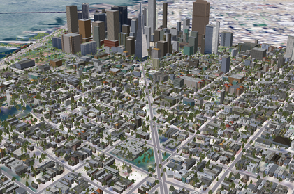
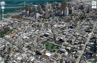
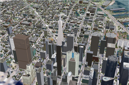
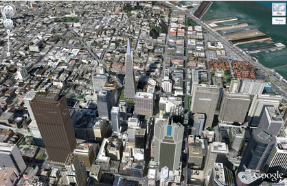
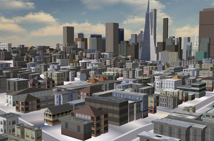
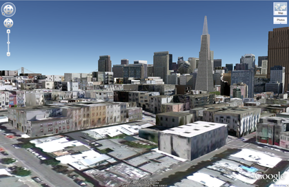
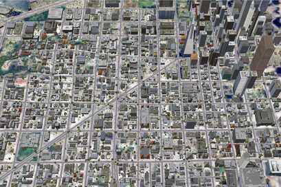
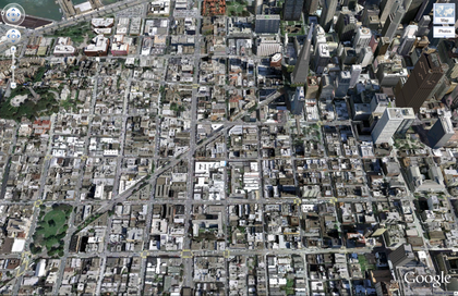
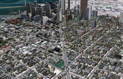
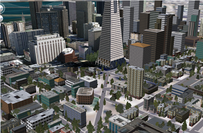
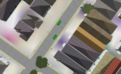
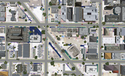
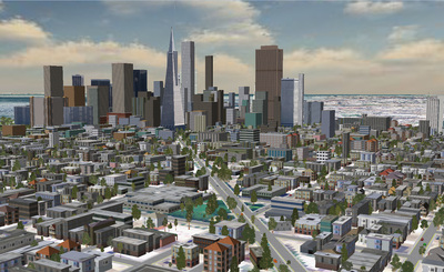
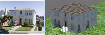
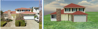
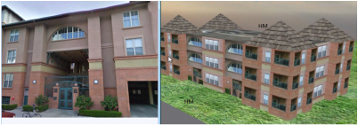
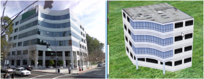
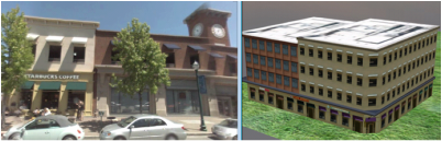
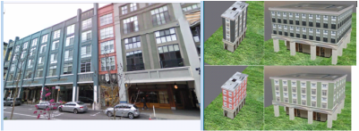
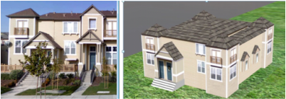
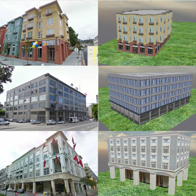
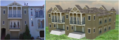
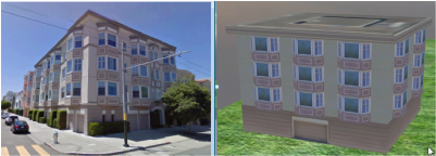
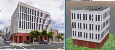
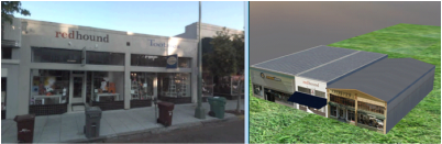
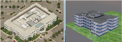
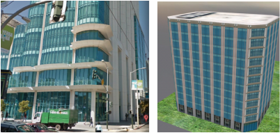
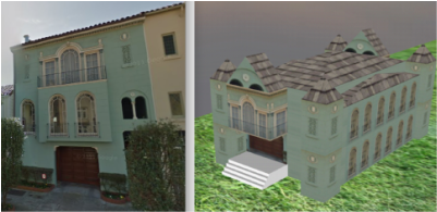
    Visual Comparison of 3D Models

    These pictures compare the visual results of our system to those obtained by the aerial photographs and building-database provided by Google Earth. While the objective of our system is *not* to precisely recreate a current city, these pictures given a comparative indication of the level of plausibility and realism our system can automatically produce from GIS data and simulation database outputs.
    Picture
    Picture
    Picture
    Picture
    Picture
    Picture
    Picture
    Picture
    Picture
    Picture

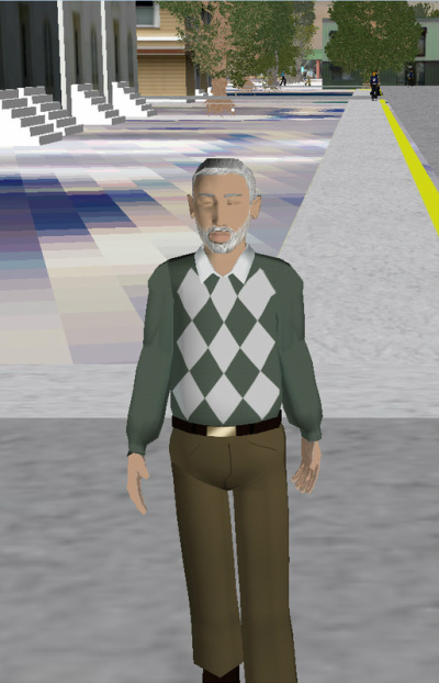
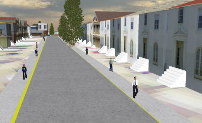
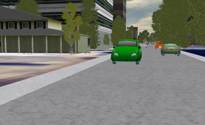
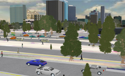
    Pedestrian and Vehicles
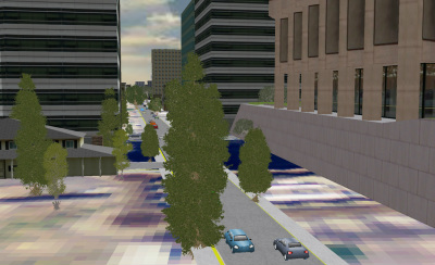
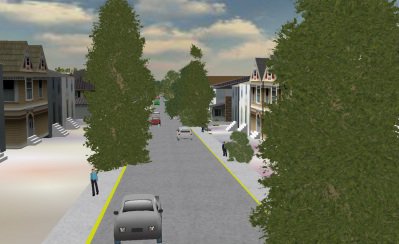
    Picture
    Picture
    Picture
    Picture
    Picture
    Picture
    Picture

    Trees

    Picture
    Picture

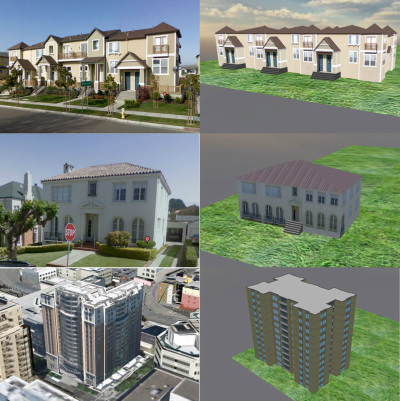
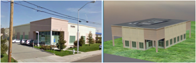
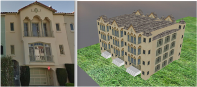
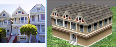
    Real-building photo to synthetic building model comparisons

    Picture
    Picture
    Picture
    Picture
    Picture
    Picture
    Picture
    Picture
    Picture
    Picture
    Picture
    Picture
    Picture
    Picture
    Picture
    Picture
    Picture
    Picture
    Picture
    Create a free web site with Weebly