Urban Weather
Contrasting impacts of urban forms on the future thermal environment: example of Beijing metropolitan area
|
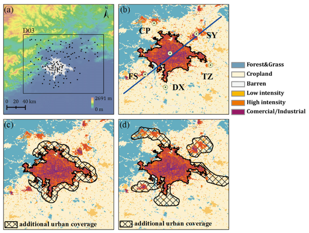
Abstract. This study investigated impacts of urban forms on the future thermal environment over Beijing, the capital city of China. Beijing is experiencing remarkable urban expansion and is planned to undergo the transformation of urban forms from single-centric (compact-city) to poly-centric city (dispersed-city). Impacts of urban forms on the future thermal environment were compared and evaluated by conducting numerical experiments based on a regional atmospheric model coupled with a single-layer urban canopy model as well as future climate forcing output from a global climate model. Results show that a dispersed city is efficient in reducing mean urban heat island intensity, but produces larger thermal loading and deeper thermal feedback at the regional scale compared to a compact city. Thermal comfort over downtown areas is reduced in compact-city scenario under future climate conditions. Future climate contributes almost 80% of the additional thermal loading over urban areas, with the remaining 20% contributed by urbanization (for both the compact-city and dispersed-city scenarios). The thermal contrast between the two urban forms is dominated by the expected future climate change. This study leads to two complementary conclusions: (i) for developing assessments related to current climate comfort, urban form of the city is important; (ii) for assessing future climate change impacts, the areal coverage of the city and urbanization extent emerges to be more important than the details related to how the urbanization will evolve.
|
|
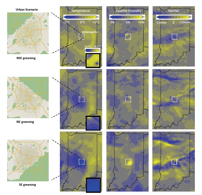
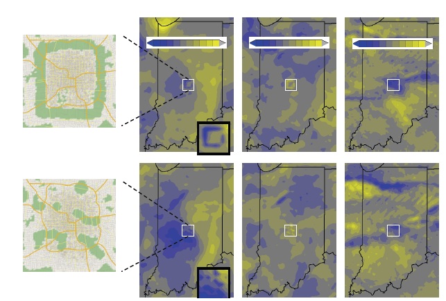
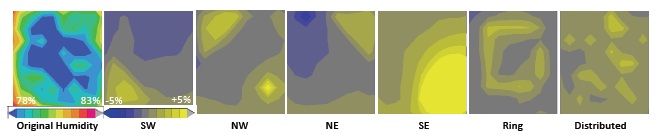
Visualization-based Decision Tool for Urban Meteorological Modeling
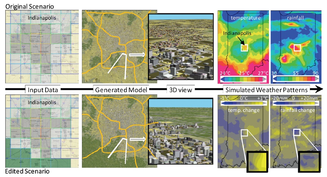
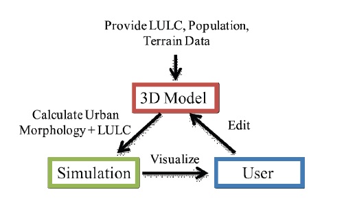
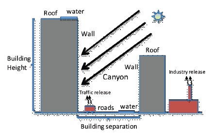
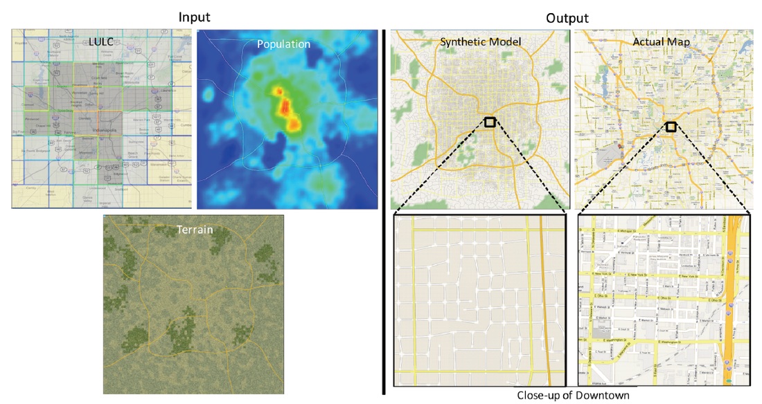
Abstract. We present a visualization-based method for a decision tool that enables exploring and understanding the link between urban land use planning policies and urban weather, in particular thunderstorms, heavy rainfall, and temperature changes. Our work combines recent work from urban planning, weather and climate studies, and visualization and computer graphics. Results from meteorological studies show that regional climate is related to regional land-use (i.e., the shape of urban and green spaces). We use work in procedural and urban modeling to demonstrate how to generate 3D city models from only coarse specifications of 2D fields. The result of our work is the compelling ability to quickly and interactively generate models of current cities and of potential future city configurations with greening patterns which are then used in simulating regional meteorology. We enable, and demonstrate, a first feedback loop of urban land use planning for mitigating extreme weather and climate change impacts in urban areas, yielding quick and intuitive controls and visualizations of how cities affect weather andvice versa.
|
|